MOUNT PLEASANT WWII ARMY TRANSIT CAMP
Some background detail about those Nissen huts on Mount Pleasant.
By Geoffrey Ellis
Newhaven has hosted many temporary military camps over the years, the last of which was the large military encampment created on Mount Pleasant c.1940/41. Seventy years on, only residual evidence remains of nearly 100 Nissen huts and about a dozen larger communal buildings (ablutions, Mess huts and N.A.A.F I. (Navy, Army, & Air Force Institution) and Officers' accommodation) that were sited along the then undeveloped roads of Mount Pleasant. Many Newhaven born and bred people 'of a certain age' can still recall those dark days of seventy-odd years ago, but later generations and 'newcomers' are often less well-informed about the why's and wherefores of yesteryear.
The physical evidence (much now disturbed) of former Nissen hut foundations lies in the flattened ‘levels’ parallel to, and set back from, some roads, Documentary evidence can be found in the maps and photographs of yesteryear that provide an explanation to the ‘sunken gardens’ of these properties; but to understand why Mount Pleasant was chosen for the encampment it is necessary to look back to the 1900s.
A grand scheme for Mount Pleasant Estate was published in 1904. Roads were laid out and water mains installed, and the whole territory was divided up into 20ft-wide by 100ft-deep plots, but for a variety of reasons (the Great 1914-18 War, and the post-war recessions of the 1920s and 1930s) only a handful of properties ever materialised. See 'The Mount Pleasant Building Estate c.1903' article on this website for more detailed information.
With the declaration of war by England and France on Germany in September 1939, there came a need to prepare for the protection of the South Coast, particularly where there were pre-existing installations considered to be of military advantage – such as Newhaven Harbour with its port, marine workshops, and railhead. A military camp was required to accommodate soldiers defending the port and local hinterland with guns and searchlights, and also for troops in transit and there was nowhere better than the under-developed hillside estate to the east of the town and harbour to create it.
In 1940, no roads on Mount Pleasant had been properly made up; the army put some hardcore on the chalk bedrock and covered it with a layer of tarred cobble as a temporary measure to create a useable surface for vehicular traffic. The few existing residential properties had individual cesspits because there was no main sewer. The army had to provide its own drainage scheme for its ablutions and canteens. (Lengths of abandoned salt-glazed drainpipes can still be found running beneath post-1950s properties). The few street lamps that existed were disconnected because of wartime blackout regulations. Substantial wooden poles (a few of which remain to this day on unadopted roads, serving as street-lamp standards) then carried the overhead electrical distribution. The army used a number of these poles on which to mount their Tannoy loudspeakers that sounded the Reveille every morning; the fanfare was usually succeeded with some choice Anglo-Saxon military verbal encouragement that was clearly distinguishable half a mile away.
The hut-count for each road was as follows; Arundel Road, 12 Nissen & 8 communal huts; Claremont Road, 22 Nissen huts; The Crescent, 9 Nissen huts; Crest Road, 4 communal huts, Fairholme Road, 13 Nissen huts & 3 communal huts; Kings Avenue, 2 communal huts; Mount Road, 22 Nissen huts; and Seaview Road, 14 Nissen huts. Accommodation in the Nissen huts was basic, with just a bed and locker per occupant, and up to ten occupants per hut. Some huts enjoyed the added luxury of an external Elsan chemical toilet.
During the war this was a secret area and photographs were strictly forbidden, however post-war photographic evidence taken by the RAF in 1946 has been discovered in the National Monuments Record, Kemble Drive, Swindon, that shows the whole of Denton, Mount Pleasant, South Heighton, and Newhaven (East of the river only). This is a 10” x 8” high-resolution vertical photograph taken on 16 April 1946 with perfect visibility and no cloud occlusion, which shows every property and bomb crater in the area. The photograph is English Heritage property and cannot be shown here for copyright reasons. The NMR photograph reference is “RAF/3G/TUD/UK/149 FR 5185 16 APR1946”; it is available as a photocopy (not recommended), laser-scanned copy (cheap but poor) or glossy photograph (excellent, but pricey). Email nmrinfo@english-heritage.org.uk for prices. Other photographs (illustrated here) have been discovered in Newhaven Local & Maritime Museum.
Probably the most unexpected revelation illustrated by the NMR photograph is the absolute myriad of footpaths criss-crossing the undeveloped and untended grassland between the Nissen huts of neighbouring roads. By contrast the diagonal view, taken at a later date, shows the huts from a different perspective but is far less spectacular as regards displaying the paths. At the time of this photograph the communal huts on the lower NW end of Arundel Road had just been demolished.
A corner of Ordnance Survey map TQ4502 (Scale 1:2500 or 25.344” per mile) (undated but presumed 1942-ish) is reproduced here that shows every Nissen hut and communal military building on Mount Pleasant and correlates closely with those visible in the abovementioned photographs. It lacks only the two larger wooden huts on the corner of King’s Avenue and Arundel Road where today there are three pairs of semi-detached houses. These were decidedly more comfortable and almost certainly Officers' quarters. They do not feature on the OS map and are presumed to have been later additions.
Soldiers were also billeted locally in private houses wherever there was spare accommodation. Landladies were pleased to be able to supplement their meagre income with the main breadwinner away from home, fighting on a different front.
The camp mainly accommodated soldiers from all over England posted to the South to become ‘battle-hardened’ and defend the local area. Others were in transit ‘waiting’ embarkation to the Continent (particularly Canadians involved in the Dieppe Raid in August 1942, and later, allied troops destined for the Normandy Landings in June 1944). At times, such as these two major assaults on the French coast (Dieppe 1942 and D Day 1944), the camp was totally inadequate for purpose, and the fields alongside the main road from Newhaven to Seaford were temporarily populated with vast numbers of tents.
After the war, most of the Nissen huts were taken over by the local authority and modified into temporary dwellings to accommodate those whose homes had been lost or damaged by enemy action pending redevelopment and reconstruction of the damaged properties. ‘Squatters’ were quick to occupy the two larger wooden huts mentioned earlier on the corner of King’s Avenue/Arundel Road. Another page on this website called ‘More about Mount Road’ contains comments by former inhabitants of some of the Nissen huts.
Mention must be made of Mr & Mrs Clare who lived at Glen-Roy, (now 10 & 10A) Station Road, opposite to where the Denton Corner shops are now situated. Throughout the war these kind benevolent Christian souls provided a rest and recreation room for members of H.M. and Commonwealth & U.S.A. Forces, Sunday to Friday, 6 – 9.30 pm, where refreshments were available for a small charge. Writing materials, and morning and evening newspapers were also available free-of-charge. Newhaven Museum has an A4 ring binder (No. 28) dedicated to this couple with photocopies of their Visitors’ Book, that also includes copies of many tributes and commendations, and records nearly 300 comments made by military visitors of all ranks, services and nationality from 30th May 1940 to December 1946. Their Visitors’ Book probably contains the only existing source of details of the enormous variety of individuals and military units that passed through this camp, British, Canadian, and American. Another page on this website called ‘The Clares, Glen-Roy & the Army’ is dedicated to them.
It is a worrying thought to think that many soldiers probably spent their last nights in these huts. I shall forever live with one thought that perpetually haunts me. During the war I lived in Russell Terrace in Avis Road. There was a right-of-way across the field opposite (that is now Paradise Park) with a stile close to the road, where on one memorable summer’s day I stood and watched a convoy of dozens of army troop transporters making their way towards Denton Corner (presumably heading for the Transit Camp). I waved to the troops as they passed. What amazed me was that one or two soldiers in almost every lorry tossed coins out onto the road at me as they passed; Pennies, sixpences, shillings, and the odd florin. At the time I was highly delighted to collect these coins as they fell on the road. Since then however, in the light of my research into WWII history, I’ve had cause to consider why so many of these soldiers should have behaved in such a like manner, lorry after lorry after lorry, quite independently.
I was then seven years old; school age but not at school, and outside in glorious weather. Could it be that this had been early August 1942? Too young to understand such concerns then, could it be that these soldiers sensed that their futures were diabolically bleak and that coinage had no value where they were going? Did they know they were part of Operation Jubilee otherwise known as the Dieppe raid? It is perhaps better that I never know for certain.
Development during the 1950s and 1960s saw the Nissen huts and army communal huts demolished, to be replaced with modern bungalows and houses, with buried main sewers and gas, water, electricity and telephone services, erected on plots of land determined by the Mount Pleasant Building Estate scheme of 1903. Most of the roads were fully developed with pavements, proper street lighting and drainage and were adopted by the local authority, but a few still remain with the temporary road surface laid down by the army back in the 40s. These unadopted roads have since become seriously worn out through use and neglect and still await attention. The day will surely dawn when these last remaining vestiges of military encampment are finally eradicated, and then the only lasting evidence will be these words.
1904 Publicity for Mount Pleasant Estate.
Courtesy of Newhaven Local & Maritime Museum.
Mount Pleasant Estate provides the backdrop for this photograph of Newhaven Harbour Continental Berth and Sleepers Hole c.1905. It is clear that additional roads have been marked out for inclusion in the Mount Pleasant Estate Scheme. However, they never materialised.
Courtesy of Newhaven Local & Maritime Museum.
1904 Publicity for Mount Pleasant Estate.
Courtesy of Newhaven Local & Maritime Museum.
An offer not seen today!
Courtesy of Newhaven Local & Maritime Museum.
Diagonal aerial view of Mount Pleasant c.1950 showing the Nissen huts and some of the remaining communal huts (Ablutions, Mess huts, & N.A.A.F.I.) huts, a few of which have already been demolished at the NW end of Arundel Road by the time of this photograph. Many of the chalk footpaths between the huts are still prominent.
Courtesy of Newhaven Local & Maritime Museum
A corner of Ordnance Survey map TQ4502 (Scale 1:2500 or 25.344" per mile) (undated but presumed 1942-ish) is reproduced here that shows all but two Nissen huts and military communal buildings on Mount Pleasant and correlates closely with those visible in the abovementioned photographs. It lacks only the two larger huts on the corner of King's Avenue and Arundel Road on the spare plots opposite the three huts shown here; these must have been late additions.
© 1996 Geoffrey Ellis
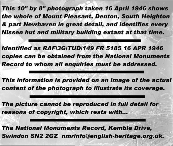
NMR Ref: "RAF/3G/TUD/UK/149 FR 5185 16 APR1946". This photograph shows the whole of Denton, Mount Pleasant, South Heighton, and Newhaven (East of the river only). This is a 10" x 8" high-resolution vertical photograph taken on 16 April 1946 with perfect visibility and no cloud occlusion, which shows every property and bomb crater in the area. The swing bridge is beneath the word 'Drive'; South Heighton Caravan Park is beneath the word 'reasons'; and the A259 leading towards Seaford is beneath the date '1946'. Mount Pleasant is just off-centre. See text for other information.
© English Heritage (NMR) RAF Photography. Permission to use this image has been granted under fomal licence AP47894.